The longest river in Northern Ireland is the River Bann.
Running approximately 80 miles long, the Bann is part of Northern Ireland’s history, geography, and politics. Let’s look at why this river is so significant.
What is the Longest River in Northern Ireland?
Geography of the River Bann
Although there is some disagreement about the exact length of the River Bann, the general consensus is that it’s around 80 miles long. Remember, Northern Ireland is roughly the size of one small state in America, so having an 80-mile river is significant.
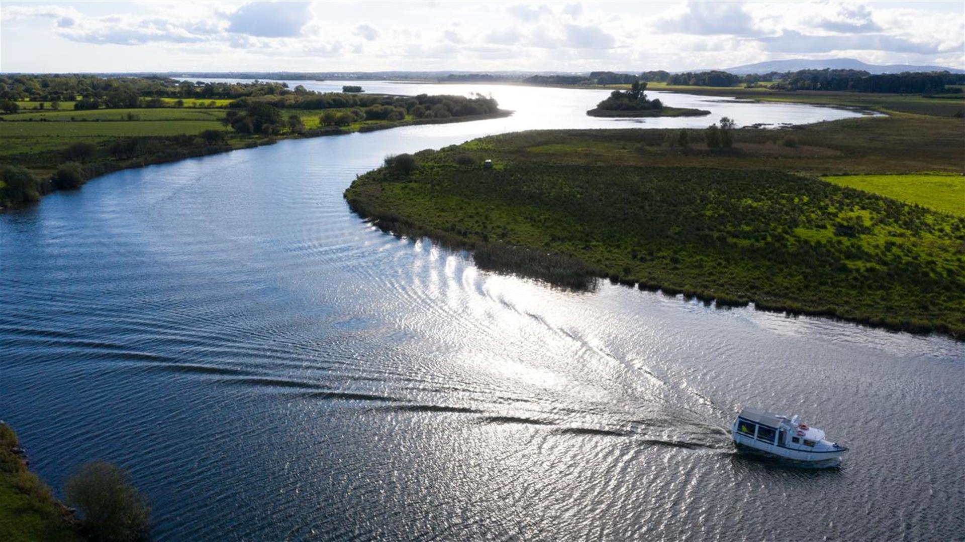
It runs from its source South East, all the way to the country’s Northwest Coast and, like most rivers, runs at different widths throughout the country.
The rivers source is located in the Mourne Mountains of County Down, in the “Sleive Muck” area. For the first 42 miles, it’s the “Upper River Bann”. Then, when it meets Lough Neagh, where it partially drains out. For the rest of its 38 miles, it’s called the “Lower River Bann”.
History of the River Bann
The history of the Bann is the history of Ireland. One historian, C. Michael Hogan, says that humans settled by the river when they first came to Ireland. The river also gave them fertile land, fish, and fresh drinking water.
But, in more recent history, the river has played a large part in Northern Ireland’s linen trade. The first mill to take advantage of the river was Hilltown, near the Mourne Mountains. Thanks to the quick speeds of the river, linen could be transported from the field to the mill to the factories much quicker than if it had to be delivered via horseback.
Politics of the River Bann
It seems strange to say that a river is “political” but, as anyone who has studied politics might know, physical boundaries can often become political boundaries.
Whilst it’s not set in stone or official in any way, Northern Ireland has a “Bann Divide” – dividing Northern Ireland into East and West. The East of the country is majority Protestant and Unionist. It’s home to the capital – Belfast.
The West, however, is majority Catholic and Nationalist.
This is changing over generations, and census data reveals a changing picture in Northern Ireland, but to date the “Bann Divide” has been a widely discussed theory, with some believing “west of the Bann” has received lower levels of investment from Stormont and Westminster.
Where does the River Bann Flow Through?
The River Bann flows through Derry (Londonderry), Antrim, Down, and Armagh counties. Let’s look at some cities and towns the river goes through, however this is not exhaustive.
Coleraine: Coleraine is the biggest town in the north coast area and acts as a gateway to seaside resorts including Portrush, Portstewart and Castlerock.
Ballymena: Ballymena is a famous market town known for being the ancestral home to Chester Arthur, America’s 21st President, and more recently Hollywood’s very own Liam Neeson.
Lisburn: The historical home of Northern Ireland’s linen industry and just a short distance from Belfast.
Newry: A border town between Northern and the Republic of Ireland. This town is approximately 1 hour from both Belfast and Dublin.
What is the River Bann used for today?
Today, the River Bann is more of a destination for locals and tourists alike, rather than heavy industry or travel.
With beautiful banks, a network running 80 miles long and quality fresh-water fishing and boating facilities, the river continues to serve a purpose in the 21st century within Northern Ireland.
Other Rivers in Northern Ireland
There are many, many rivers flowing through Northern Ireland. Below are just a few:
River Lagan flows directly through Belfast.
River Foyle is approximately 20 miles long, flows directly through Derry, and travels between both Northern Ireland and the Republic of Ireland.
River Colebrook in County Fermanagh is a hotspot for Salmon and Trout fishing – with private fishing available on the Colebrooke Park Estate.
River Roe is 34 miles long. It formed millions of years ago when the glaciers melted, leaving a “glacial valley basin” from which the water could flow.